The new farmers should utilize multispectral Image from satellite and drone, and Big Data to processing the condition of soil and weather in advance for precision farming.
Ammarin Daranpob, space technology expert as a consultant of AgriTech Global Services Co., Ltd. said digital transformation has restrictedly progressed as majority of Thai farmers did not work on smart farm platform, but they still function a traditional way. The farmers should utilize technology for products improvement and efficiency.
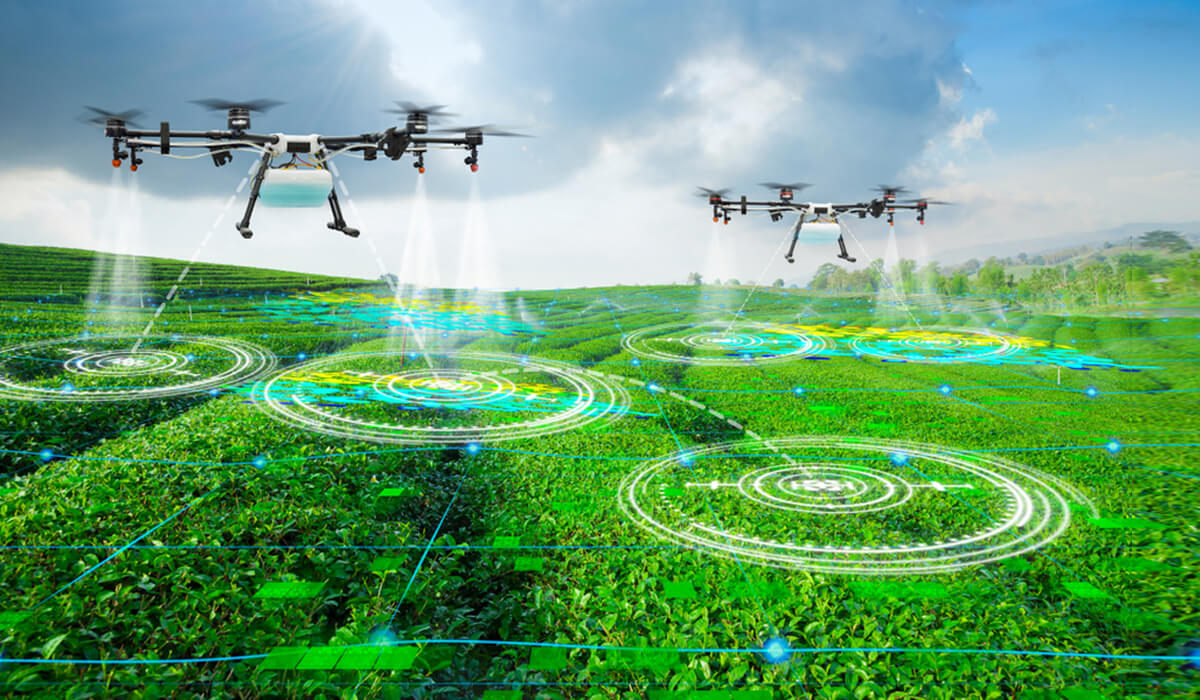
New farming technology such as the multispectral image functions as an “X-ray” recording the change of crops through a use of artificial intelligence (AI) surveying for any malfunction, while drone with multispectral image runs as a computerized tomography scan or CT Scan diagnoses the plant diseases. Drone is more advantage because it can access to the areas that cannot be done by human and the data collected by hyperspectral images is useful for the yield improvement and for the efficiency of farms.
It should have collaboration among the private, public and agricultural sectors creating a platform by making use of satellite and drone technology. The collaboration can be formed in a “social enterprise” model because technology cost is cheaper than the past, modern and it saves production cost, while users can forecast and monitor the plants in real-time.
“Farmers cannot take care every single plant due to the large-scale agricultural plots, and thus technology is the answer. The plants at early stage of sickness is invisible to naked eyes, but multispectral image technology can detect these unusual matters, so we should promote the use of these innovations to the farmers,” he said.
Moreover, the hyperspectral images technology can save cost of travelling across the province as it can shoot 12 photo a day. In the past, it took 14-21 days as it must wait for the satellite is round the globe. With the multispectral image technology, there will be 4,380 images of changing agricultural crops a year, or 12 images a day. These images are the primary data for running big data analytics where users can view the crop growth, weather condition, geography condition, humidity, landscape, and they can run a yield comparison at the plot scale, across the provinces and across the countries.
“Consistent data feed is the most important factor of big data in the agriculture sector so that the AI can efficiently and precisely analyze any changes caused by database.”
The loan of 400 billion baht to revitalize businesses and society affected by the coronavirus disease should be also spent for the Thai agriculture by promoting the farmers to be able to access satellite and drone technology and innovation because these are the future of the new farming,” said Ammarin.

